
National Weather Radar Mosaic Loop Your Real-Time Guide to Storm Tracking
As weather events become more unpredictable and extreme, real-time weather monitoring systems are more important than ever. The National Weather Radar Mosaic Loop is one of the most valuable systems for meteorologists, emergency planners, travelers, and the general public. It offers a dynamic, nationwide representation of precipitation and storm activity by combining radar imagery from across the United States into a single, easy-to-read animation.
Whether you’re bracing for a thunderstorm, watching a snow front, or monitoring hurricanes from afar, the radar mosaic loop is a trusted window into what’s going on in the skies.
What Is the National Weather Radar Mosaic Loop?
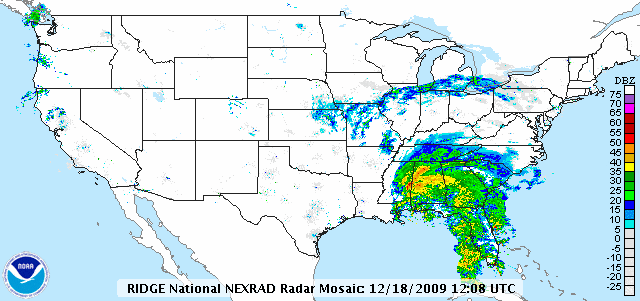
The National Weather Radar Mosaic Loop is an animated display that blends radar images from more than 140 Doppler radar stations operated by the National Weather Service (NWS) and NOAA (National Oceanic and Atmospheric Administration). Instead of monitoring weather in just one location, the mosaic merges radar scans from across the country into a continuous national map.
The result is a looping radar sequence—typically covering the past 1 to 3 hours—that shows precipitation patterns, storm development, and movement across the continental United States (CONUS).
How It Works
Each Doppler radar station emits electromagnetic pulses that bounce off particles in the air, such as raindrops, snowflakes, or hail. The radar then collects the reflected waves and processes them to determine:
-
The distance of the precipitation
-
The direction and speed of its movement
-
The type and intensity of precipitation
This data from each radar site is merged using specialized software, creating a real-time national animation. The mosaic loop is typically updated every 5 to 10 minutes, providing near real-time weather data.
Main Characteristics of the Radar Mosaic Loop
-
National Coverage: Combines data from hundreds of radar stations across the U.S.
-
Real-Time Animation: Shows movement and intensity of storms over a 30 to 180-minute window
-
Color-Coded Display: Visualizes precipitation intensity—from light rain to severe thunderstorms
-
Additional Layers: Some versions include overlays such as wind speed, lightning strikes, storm alerts, or satellite imagery
-
Web & Mobile Friendly: Available on websites, apps, and mapping platforms for easy access anywhere
Why the Radar Mosaic Loop Is Necessary
The radar mosaic loop is not just a technical tool—it’s a critical resource for public safety, emergency management, travel planning, and everyday decisions.
1. Severe Weather Awareness
Whether it’s flash floods, tornadoes, or blizzards, being able to visually track a storm’s development and path helps individuals and communities take action quickly. Meteorologists rely on radar loops to issue early warnings and monitor dangerous conditions.
2. Travel and Aviation
Airline dispatchers, pilots, and transportation departments use national radar loops to assess storm risks, reroute traffic, or delay flights to ensure safety.
3. Emergency Management
Local governments and emergency services use the radar loop to decide when and where to open shelters, evacuate high-risk areas, or deploy resources for disaster response.
4. Everyday Use
Homeowners use it to decide whether to delay outdoor activities. Farmers use it to time irrigation. Event organizers use it to determine weather windows for gatherings.
Where to Find the Radar Mosaic Loop
You can access the radar mosaic loop from several trusted sources:
-
weather.gov – Official site of the National Weather Service
-
NOAA’s NCEP – National Centers for Environmental Prediction
-
Weather Underground – Offers interactive radar maps with overlays
-
The Weather Channel – Includes future radar animations
-
Windy.com & RadarScope – Popular among hobbyists and professionals for advanced features
These platforms often allow zoom, time selection, and toggling between different data layers.
Limitations to Consider
Despite its value, the radar mosaic system has a few technical limitations:
-
Radar Shadows: Terrain such as mountains can block radar signals in certain areas
-
Ground Clutter: Trees, buildings, and other structures can reflect radar waves and cause false readings
-
Update Lag: Although updated frequently, radar loops may lag behind actual conditions by 5–10 minutes
-
Signal Interference: Heavy rain or hail can disrupt radar signals and reduce accuracy
Nevertheless, when combined with satellite data, forecasts, and warning systems, the radar mosaic remains one of the most reliable tools for short-term weather monitoring.
Conclusion
The National Weather Radar Mosaic Loop transforms individual radar images into a powerful, unified view of weather across the country. It delivers crucial insight into storm formation, precipitation movement, and real-time changes in weather systems—empowering people, businesses, and emergency responders to make informed, timely decisions.
Whether you’re preparing for severe weather or simply watching the skies, the radar mosaic loop keeps you informed, aware, and one step ahead of the storm.


